|
|
The Manor of Bunstrux and Richardines.
The manor of Bunstrux and Richardines is not mentioned in William
the Conqueror’s Domesday survey of 1086 and may have been too small
to be distinguished from the much larger manor of Tring.
Tring was gifted to Faversham Abbey in Kent by Matilda and Stephen
in 1148 [1]. In about 1439 the manor of
“Bunstreux and Richardyns” appears in the records of the Abbey when
the manor was granted to Sir Robert Whittingham, Sheriff of Essex,
who also held the manor of Pendley. The grant for Bunstreux
and Richardyns included a manor house, pasture for grazing animals
and firewood and wood for fences from the Westwood [2].
Bunstreux and Richardyns appears not to have been a contiguous piece
of land but scattered holdings in and around Tring and Hastoe.

The red and white roses of
Lancaster and York.
Sir Robert Whittingham had been a supporter of the Lancastrian Henry
VI and was knighted by him in 1439. After the accession of
Edward IV, Whittingham was accused of treason and deprived of his
possessions by the Crown. In 1462 Whittingham’s lands passed
first to the Bishop of Exeter and then to Sir Thomas Montgomery, a
supporter of the House of York during the Wars of the Roses.
Whittingham’s son, also called Robert, died at the battle of
Tewksbury in 1471 and shortly after his death the act of Parliament
convicting his father was declared null and void. As a result,
his widow, Catherine, regained Bunstrux and Richardines along with
the Whittingham’s other manors of Pendley and Halstow (Hastoe).
Together these manors comprised twenty messuages (a property
including a house) and ten cottages and amounted to over 900 acres
of arable land, pasture and wood [3].
The Arms of Verney of Middle
Claydon, Buckinghamshire.
On Catherine’s death the Whittingham lands passed to her daughter
Margaret, the wife of John Verney. The Verney’s family seat was in
Middle Claydon in Buckinghamshire and Sir Ralph Verney, John’s
father, was a Member of Parliament and Lord Mayor of London. The
manor of Bunstrux and Richardines was eventually joined with the
manor of Pendley in about 1608, the Verney’s having, by this time,
sold it to Sir Richard Anderson (1585-1632).
The Origin of the Name “Bunstrux.”
Bunstrux has had various spellings over the years including
Bunstreux in about 1439, Bunstrux in 1462, Bonstrowys in 1484/5,
Bunxstruxe in 1552-1585, and Bunstrucks.
In her book The History of Tring local historian
Sheila Richards suggested the name has its origins with John
Bunstriube who is mentioned in the early manor records and whose
name may be a corruption of the French bon estrieu(er) which means
the stirrup-man or a knight’s bearer.
Richardyns or Richardines is spelt variously in the records and
would appear to be a personal name. Two fields in Hastoe are
referred to as Richardines on the schedule attached to the Tring
Enclosure map, made in about 1799. The fields are located in
the triangle of land bounded on the north by Grove Wood and by
Hastoe Lane to the east and the lane that leads to Hastoe House to
the west. Hastoe Farm is to the south. |
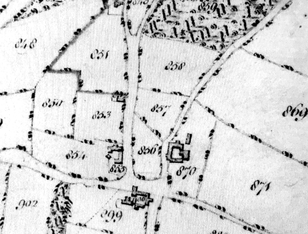
Tring Enclosure map c.1799: Two fields
called Richardines are numbered 857 and 858.
|
About 1529 the rents for the manors of Pendley, Bunstrux and
Richardines, among others, were the subject of Chancery proceedings
brought by John Drewe of Bristol and his wife Elizabeth who he had
married in 1527. She was the widow of Sir Ralph Verney the younger,
son of John and Margaret Verney.
After the Dissolution of the Monasteries.
Following the Act of Supremacy in 1534, which made Henry VIII
supreme head of the church in England Wales and Ireland, many
estates were taken from monastic houses such as Faversham Abbey and
passed to the nobility and institutions favoured by the King, for
example some university colleges.
Manor court rolls are the written record of a manor’s administration
and those that survive for Bunstrux start in 1541 when land in
“Marsshe” croft is recorded as being in the manor of Bunstrux.
|
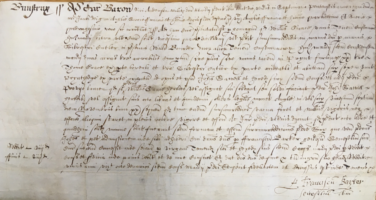
|
An early Bunstrux Manor Court Roll
document - courtesy of
Hertfordshire Archives and Libraries
In 1554 Queen Mary granted the manor of Bunstrux along with the
rectory and avowson [4] of Tring to Christ Church
in Oxford, which had been re-founded by her father, Henry
VIII, in 1546.
17th-18th century Land Owners and Occupiers.
Title deeds and manor court rolls in Hertfordshire Record Office
provide much information for the 17th and 18th centuries and tenants
of Bunstrux and Richardines manor include several prominent Tring
families.
In 1616 William Grace surrendered two acres in a field called Prynt
Furlong, which abutted Prynt Hedge, to John Sawell. Thirty-seven
years later Thomas Grace of Ford died and bequeathed Bunstrux Close
to Thomas Grace of Startops (presumably a relative).
In 1657 Thomas and Anne Goodchild surrendered lands and tenements in
the manor of Bunstrux to Alice Budd the wife of George Budd.
In 1701 a parcel of land in Hitchin field, one of Tring’s large
common fields, was owned by the Littleton family. This may be the
same piece of arable and meadow mentioned in the will of Jacob
Littleton in 1721 when it passed to his daughters, Anna the wife of
John Grace and Elizabeth the wife of Joseph Nash.
Great Hawkwell, another of Tring’s common fields, also had parts
belonging to Bunstrux Manor. In 1704 William Foster of
Parsonage Bottom surrendered a piece of land bordered by Longbridge
Brook to John Foster the younger of the “Banck”.
Other tenants’ names that appear in the Court Rolls are John Sutton,
John Fincher, John Foster, John and Elizabeth Charlwood.
A list of Quit Rents for Bunstrux Manor survives from 1719-1734.
The proprietors were John and Michael Seare of Tring Grove who paid
the Lord of the Manor, William Gore, £49.5s. In 1733 William
and Charles Gore exchanged lands with John Harding which included
part of a yard in Akeman Street, Great Home Close, Little Home
Close, Pegg’s Croft, Whitecroft, part of Shitten Shoe, a parcel of
land in the Downe common field, Gore’s Gap and three acres of land
in “Absticle Hill”.
Some of these closes and fields are named on Joseph Colebeck’s
estate map made around 1719 for William Gore. For example:
Bunstrux Close, Whitecroft and Shitten Shoe.
An index of tenants and rents who paid Quit Rentals to Henry Guy,
Lord of the manor of Bunstrux, also survives and is dated 1762-1827.
Out of a total of just over 182 acres, the largest holding by far
was that of Joseph Thomson who had nine
closes and two woods totalling 60 acres at Hastoe. Other large
land holders were William Harding with 12 acres, also in Hastoe, and
William Lake Tanner who had 12 acres. Smaller parcels of land
were held by various people in several closes in and around Tring:
for example, John Butterfield had an orchard and a close at Tring
Ford and John Rolf a close at Startops End. Most of Bunstrux
Manor’s holdings were in Tring’s common fields: Downe Field,
Goldfield, Hazely Field, Hitchins, Little Hawkwell, Great Hawkwell,
Gamnell Field and Parkhill Field. These small holdings were
typically one or two acres apiece, but a few were larger such as the
nine acres in Down Field held by
someone
called Ellis [5].
Other holdings were in Tring Field, Print Furlong, Parsonage Bottom
and Ford Furlong.
19th century Lords and
Ladies of the Manor.
The tenants of Bunstrux Manor held their land by copyhold (a
copyhold is land held from a manor). The Copyhold Act of 1852
enabled such tenants to convert their holdings to freehold on
payment of compensation to the Lord of the Manor; a process called
enfranchisement. For example, in 1864 the Reverend James
Williams of Tring Park, a tenant of Bunstrux Manor, paid 15s for the
enfranchisement of one acre of land in the Butts in Benhill Field [6].
During the 19th century the manor of Bunstrux and Richardines passed
through several hands. In 1807 Richard Bard Harcourt was Lord
of the Manor and it remained with the Harcourt family until about
1865. At this time the Ladies of the Manor were the three
spinster daughters of Charles Amedee Harcourt. The Ladies were
joined by members of the Cavendish family, plus Reginald Bridges
Knatchbull Huggissen and William August Peel. This rather
cumbersome arrangement did not last long and in 1868 Dr Thomas
Barnes, an eminent surgeon from Carlisle in Cumberland, purchased
both the Manor of Bunstrux and the manor house for £1180.
Barnes’ connection to Tring was through his wife, Anne Ismay, a
niece of William Kay of Tring Park. Barnes died in 1872 by
which time he had passed the Lordship to his daughter Mary Dunne,
wife of John Dunne, Chief Constable of Cumberland.
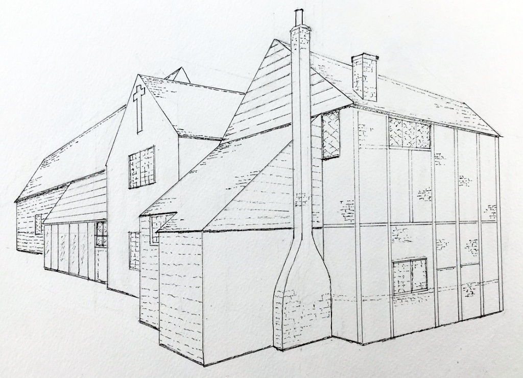
Bunstrux Manor House.
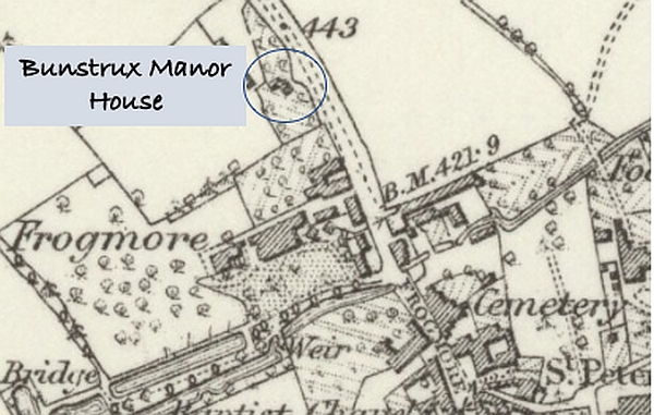
Bunstrux
Manor House 1879.
Two manor houses, one for Bunstrux on Bunstrux Hill and another for
“Ricardines” near Hastoe Green were established by the 15th century.
Bunstrux manor house stood at the south end of a pair of fields
called Bunstrux, on high ground to the north west of Tring parish
church. The position of the house is shown on maps from about
1719 and into the 20th century. In 1910 the Royal Commission
for Historic Monuments dated the house to the 16th century.
Photographs taken about this time show a brick and timber house
approached by steep stone steps from Frogmore Street. A
feature of the house was a plaster cross, about three feet high, on
the south-facing gable end. The presence of the cross is
curious – did the house have some religious significance at one
time? |
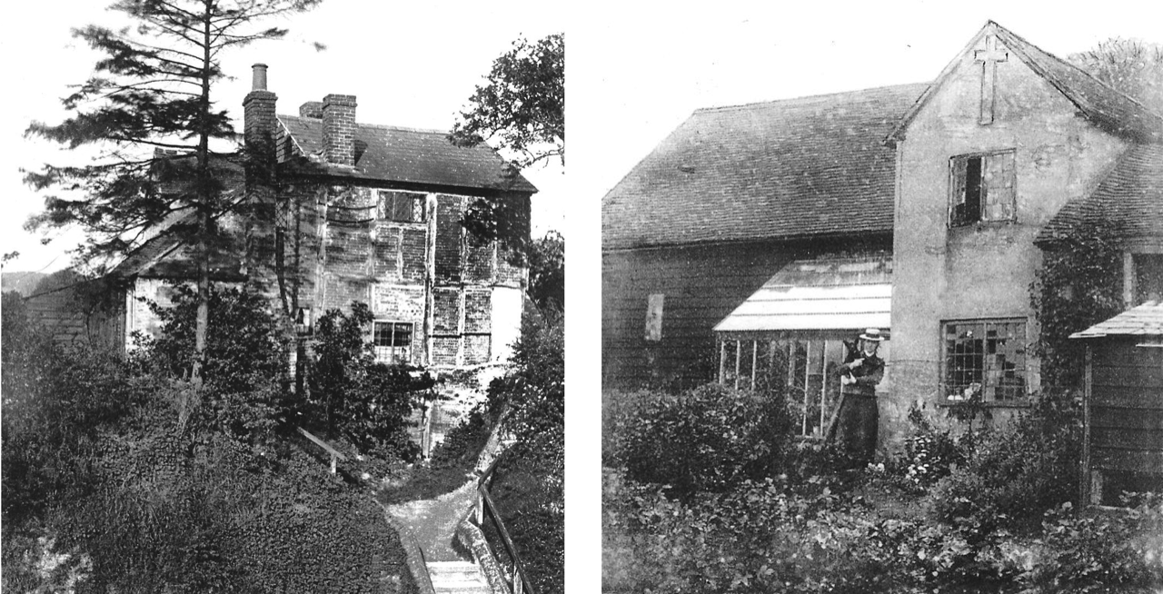
|
Bunstrux
Manor House before demolition (left) and about 1910 (right),
courtesy of Tring & District Local History Museum & Society.
The house, steps, garden and an associated barn or outbuilding are
shown on the 1887 Ordinance Survey map. The house, barn and a
well are still visible on a map revised between 1930 and 1945, and
reprinted in 1960.
The house and barn were eventually demolished and the site is now
occupied by the back garden of Bunstrux Cottage in Dundale Road and
gardens behind houses at the end of Deans Close.
19th-20th century
Inhabitants of Bunstrux Hill.
Unfortunately, Bunstrux Manor House is not identified in any of the
national censuses from 1841 to 1911, but in sale details from 1868
the Manor House was described as being used as cottages.
At the beginning of the 19th century at least one cottage as well as
the manor house existed on Bunstrux Hill. In 1834 a single
cottage on Bunstrux Hill, in the manor of Bunstrux, was advertised
for sale by Grover Smith and Grover of Hemel Hempstead. By the
time the census was taken in 1841 four families lived on Bunstrux
Hill. The heads of family were: Stephen Gates, Richard
Crocker, Thomas Wilson and Francis Baldwin. By 1851 there were
only two families: Nutkins and Abrahams; the Nutkins family stayed
put and by 1861 the Abrahams had been replaced by the Fosters and
farmer Stephen Gates and his wife Sara. Gates was occupier of
Bunstrux Manor House and its associated land in 1868 when the
property and the Manor itself were advertised for sale as part of
the Harcourt Estates.
By 1871 the families on Bunstrux Hill had changed again. The
dwellings were now occupied by three families: Eliza Rodwell and her
married daughter Charlotte Egelton and son in law James; Edmund
Norwood, wife Elizabeth and five year old daughter Susanna; and John
Crockett, his wife, two children and a lodger. Most of the
adult men were agricultural labourers and several of the wives and
daughters were straw plaiters. One boy, George Crockett, was a
silk winder in 1871. Tring
Silk Mill, on Brook Street, was opened in 1824 by William Kay
and closed in 1898.
By 1881 Bunstrux Hill was occupied by a bricklayer’s labourer, John
Foster and family, William Smith a coachman and his family,
including his 79 year old grandfather and Henry Austin, his wife and
their 35 year old son, a general labourer. Henry, his wife Eliza and
son Charles were still there in 1891 – their address was now given
as number 1 Bunstrux Hill. Number 2 was occupied by Mary
Abraham a 69 year old widow. She was possibly the Mary Ann
wife of William Abraham who had lived there in 1851. The 1891
census required householders to state the number of rooms occupied
if less than five. The houses on Bunstrux Hill had four rooms
apiece. |
|
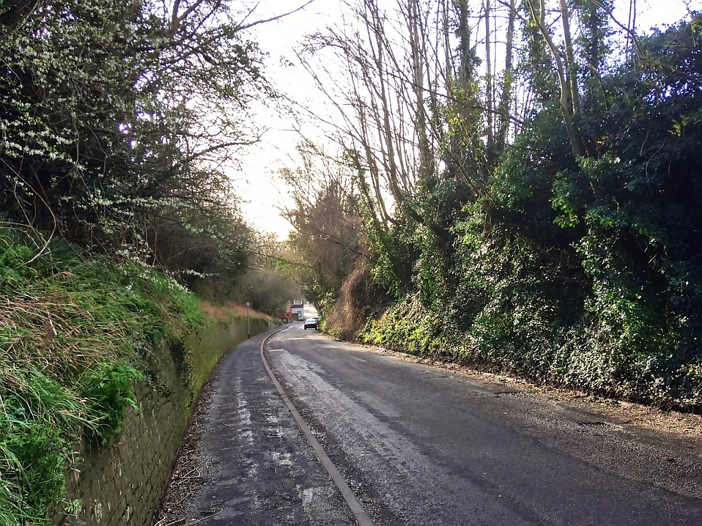
View down
Dundale Road towards Frogmore Street – photo S. Gordon.
The state of the road from Frogmore up Bunstrux Hill in the late
19th century is not known but some time before the 1870s a deep
cutting was made to reduce the gradient. It is also possible
that the cutting occurred naturally as a result of erosion by water
or traffic over many years. In September of 1892 the Local
Board accepted a tender from H. Fincher for the erection of a wall
at Bunstrux Hill. The cost, £98 15s, was a considerable sum.
The report in the Bucks Herald gives no further details but
the wall in question could be the one that runs the length of the
cutting between Frogmore Street and Dundale Road or it may be the
retaining wall on the west side of the street at the bottom of the
hill.
By the 1901 census one uninhabited house was listed on Bunstrux
Hill, presumably the former manor house. A laundry (built by
Lord Rothschild in 1890) appears in the 1911 census as “The Laundry,
Bunstrux Hill” occupied by Alice and Helen Markham who operated the
laundry. The owner of Bunstrux Manor House before 1912 was
Joseph Essam Lawson who had inherited the property from his father
in law Thomas Grace. Lawson’s daughter Christine was
photographed outside the Manor House in the early 1900s. In
1901 the Lawsons lived in Tring High Street and probably never lived
at the Manor House although Mr Lawson loaned the use of his meadow
on Bunstrux Hill for The Victoria Slate Club’s annual feast in 1904.
Lawson’s agents, W. Brown and Co., sold the property at auction in
September 1912.
By 1919 Frederick Walter Rodwell was farming the land at Bunstrux
Hill although he lived elsewhere in Tring. An article in the
Western Mail reported in September 1919 that a bloodhound
belonging to Frederick W Rodwell of Bunstrux Farm was to be used by
the local police in an experiment to track an assailant.
The land previously occupied by Bunstrux Farm appears to have been
split up sometime around 1930 when Bunstrux Cottage (later numbered
1 Dundale Road) first appeared in the Electoral Register. At
that time the cottage was occupied by the Johnson family and in
April 1934 an announcement appeared in the Bucks Herald for
the wedding between Bert Johnson, eldest son of Mr and Mrs P. Johnson,
and Miss Kingham.
Plans for the development of Bunstrux Hill began in 1913 when Lord
Nathaniel Rothschild gave Tring Council the land for twelve
cottages. The cottages comprised three terraces of four and
were built to a design by local architect William Huckvale on the
east side of Dundale Road (then called Little Tring Road). The
Council cottages were intended for local working families, although
during WW1 it was suggested that empty houses should be offered to
families from London.
Bunstrux Allotment
Gardens. |
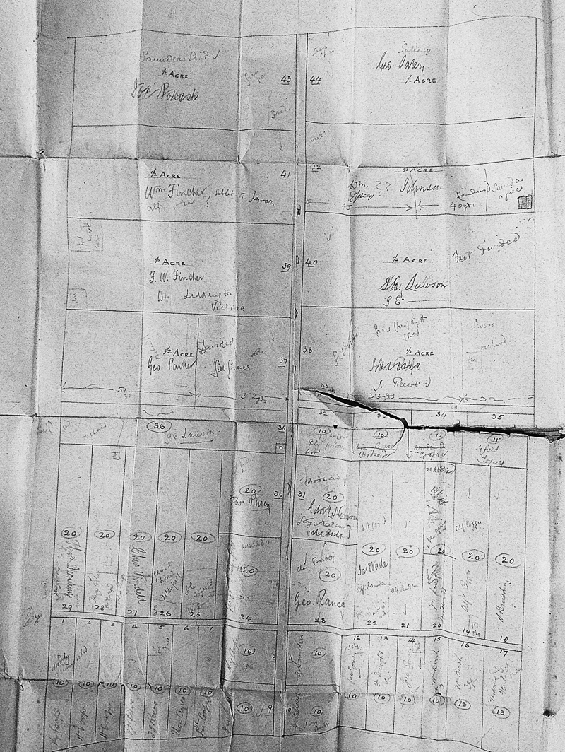
Plan of
Bunstrux Allotments – courtesy of
Hertfordshire Archives and Libraries
|
In the late 19th century part of Bunstrux field was let out for
garden allotments by the then owner Joseph Grout Williams of Pendley
Manor.
The intention was to supply garden ground for around 30 working men
of Tring. Two copies of the tenants’ terms and conditions
dated 1888 survive in Hertfordshire Archives. One was for Plot
38, let to Thomas John Rolfe and the other was for Plot 44 let to
George Sallery. The annual rent for both was £1 6s 8d.
Two of the conditions were that no work should be done on a Sunday
and that cultivation should be carried out “in the best manner by
Spade Husbandry or other manual labour”. The landlord was
responsible for the fences around the site but the tenants were “to
preserve the stakes and number of his allotment” and maintain the
‘Occupation road’ adjoining his plot. The “occupation roads”
were no more than strips dividing the site. One road ran
uphill east to west from the entrance in Dundale Road and two others
ran north south dividing the smaller plots from the larger ones.
A sketch plan, made sometime between 1895 and 1915, gives the plot
numbers, size of the plot and name of the tenant or tenants – some
plots were subdivided. A few sheds are also marked and what
may have been a well [7] in the northeast
corner of Plot 36.
The largest of the plots covered half an acre (approximately 2400
square yards) and the smallest 10 rods (approximately 300 square
yards). The smallest plots fronted Dundale Road and the
largest were at the top of the hill.
A copy of a Notice to Quit letter written to Alfred Fincher by J G
Williams’ agents, W. Brown and Co., also survives and is dated 20th
September 1911.
In 1911 W. Brown and Co. wrote a letter complaining that some of the
allotments were not being used for the purpose intended and that
during the following twelve months the ground was to be properly
cultivated and “all Buildings and wire netting must be removed.”
The allotments continued in use into the 1920s. An Ordinance
Survey map of 1924 suggests that, by this time, two plots had been
sold: it shows two small buildings of some kind within fenced plots
towards the west end of the site.
The Development of
Bunstrux Hill. |
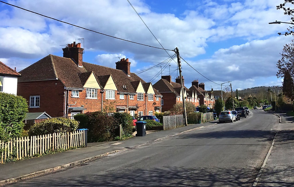
Terraced
cottages built about 1913/1914 in Dundale Road– photo S Gordon.
|
In 1925 Frank Brown of W. Brown and Co. became the first president
of Tring’s Allotment Protection Society. |
|
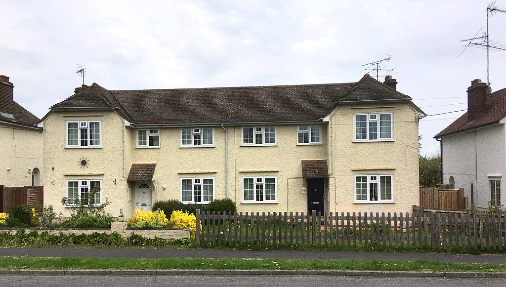
Semi detached
“Bunstrux villas” built in 1921/1922 in Dundale Road – photo S.
Gordon.
Development of Bunstrux Hill began just before WW1 when Lord
Nathaniel Rothschild had twelve cottages built on the east side of
Dundale Road (then called Little Tring Road). These, together
with the land on which they stood, were conveyed to Tring Council as
a gift in November 1914. The cottages, designed by William
Huckvale, comprised three terraces of four and were intended for
local working families, although later during WW1 it was suggested
that empty houses should be offered to families from London.
Nathaniel Rothschild died in 1915 and his son Charles
continued his father’s support for housing in Tring. In 1919 a
gift of land for 24 houses at Bunstrux Hill was made. This was
extended, at the request of the Council, to a total of six acres, to
allow space for fifty houses, some fronting the existing road and
some behind. In early 1920 a plan, under the government’s
“Addison” scheme [8], was adopted. Twelve
semi-detached dwellings of the “Parlour” [9] type
were decided upon. The architect was Charles Philips Cole of
Tring, Frank Brown’s son in law. After an initial disagreement
with the Housing Commission over the cost of the houses a tender
from J. Honour & Sons was accepted and the houses were completed in
January 1922.
In 1925 the Highways Committee agreed to tar the footpath up
Bunstrux Hill and the Tring Gas Company proposed extending the gas
main from the top of the hill to the Council cottages to provide
them with heating and lighting at a cost of 30s per house.
However, the Council rejected the proposal on the grounds of cost,
but they did agree to the redecoration of kitchens, sculleries and
outbuildings of the Council cottages and the interiors of Bunstrux
Villas – the name given to the Council’s newer semis.
A portion of Charles Rothschild’s gift of land remained unused and
in 1925 the Council started to consider how this might be developed.
The late Mr Rothschild’s trustees were keen to encourage the
building of houses for working class people and insisted that any
land the Council did not build on should be given to people to build
their own houses and not sold off.
In early 1926 the Council debated possible layouts and costs of
building on the spare land but there were problems: the shape of the
site was awkward, a new road needed to be built, a gas main laid and
part of the site would require a new and expensive sewer for surface
water. Eventually a layout for 32 houses was adopted but the
sewer and metalling of the road were omitted from the plan.
Even so the proposed road charges of £65 per household were
criticised in the local press and no applications for the free land
were received. The Council decided to shelve the scheme until
the autumn.
In November of that year the Council accepted a tender submitted by
Mr H. Fincher to extend the road at a cost of £81 4s.
Individual householders were to make their own arrangements for
sewage disposal and some could receive a government subsidy of £75.
As a result, the road charges would be considerably reduced.
Fourteen houses were planned: six fronting Dundale Road, four next
to them (presumably fronting the extended road) and four behind.
Preference was to be given to applications from those building
houses for their own occupation with the first choice given to Tring
residents.
Applications started to be received for the free plots in early
December: Miss H. Marcham of the Laundry being the first, followed
by Mr H. J. Gurney of Miswell Lane and Mr H. C. Cook of Western
Road. Further applications followed in early 1927: two pairs
of cottages by Messrs E. Smith and Son, Miss Swabey, Mr A. W. Hedges
and two further plots to Mr H. Cook. A year later Miss Violet
Lister of Tring applied. The plots continued to be allocated
throughout the following year and in 1929 Mrs Baldock, Messrs H. G.
and C. D. Saunders received a plot each and George Harrowell two
plots. The last of the plots was allocated to Mr F. Chandler
of Tring Road, Long Marston in October 1929. This brought the
Bunstrux Hill Housing development to a total of 45 houses including
the 12 cottages erected in 1919.
The increased traffic from the town to the new houses on Bunstrux
Hill evidently took a toll on the road surface. In 1929
Councillor Baldock complained that it was so bad that “he feared
that cyclists going up or down would have a serious accident one
day,” and that he had seen “a number of narrow escapes.” The
Surveyor disagreed that the road was dangerous but nevertheless
agreed to do the work as soon as he found it possible.
Buoyed by the positive response and a continued shortage of housing
the Council looked for more land that might be suitable for
development. One site, opposite the Council cottages in
Dundale Road was suggested by Mr Donald Brown [10].
The response from local investors and other interested parties was
positive and in early 1929 they were asked to form an association to
run the scheme on “business lines”. The owner of the land,
Donald Brown’s father, agreed to sell the frontage of the land (480
feet fronting the road by about 120 feet in depth) for £2 per foot
frontage. However, at that time the land was used as
allotments and so there would be no vacant possession before the end
of September. A further stipulation was that the land could
not be sold in plots of less than 200 feet. The Council, for
its part, made it clear that it did not want to be responsible for
any charges associated with making the road up or laying a new
sewer. Nevertheless six bungalows were built on the west side
of Dundale Road occupying what had been the row of allotments
fronting Dundale Road. The allotments behind remained in use
until after WW2.
By 1939 houses were occupied on both sides of Dundale Road. On
the east side even numbers ran from 30 to 72. On the west side
odd numbers 1 (Bunstrux Cottage) and 43 to 69.
Shortly after 1939 a row of semi-detached houses was built on the
west side and numbered 23 to 41. Later still, number 21 was
built adjacent to Bunstrux Cottage and a pair of semis, 28 and 30,
replaced number 30 (which was an unoccupied house in 1939).
Numbers 2 to 20 and 22, 24 and 26 appear never to have been used.
In 1944 the National Provincial Bank, executors of George Macdonald
“Donald” Brown, sold off the remainder of the plots and the present
road, named Bunstrux, now occupies the site.
By 1948 at least one house plot had been purchased by builder Albert
Prentice and planning permission was granted for a ‘semi-bungalow’
at ‘Dundale Allotments’ in 1952. |
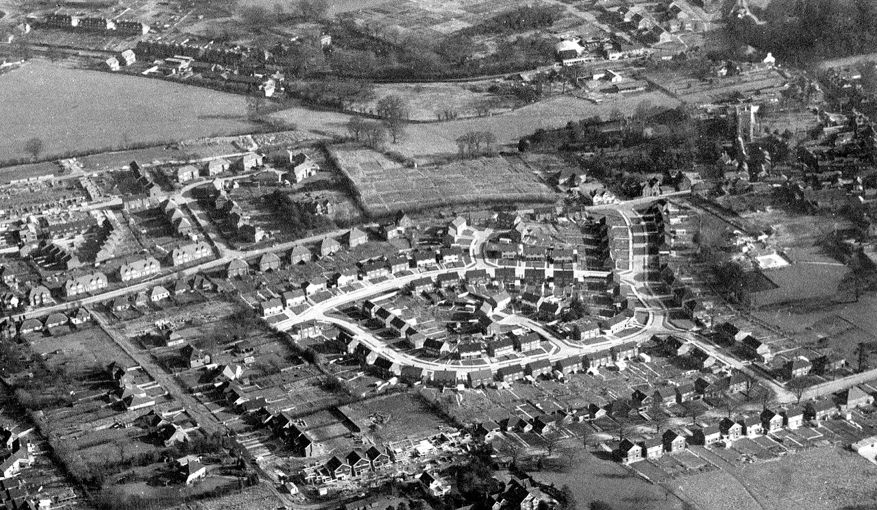
|
Tring aerial view,1964 (Bunstrux is
bottom left) - photo by Don Reed, courtesy of Tring Local History
Society and Museum.
Houses continued to be built throughout the 1950s and early 1960s
and by 1964 there were seventeen properties in Bunstrux. An
aerial photograph shows one semi-detached house, six detached houses
and one in the process of being built on the south side of the
street and six detached houses on the north side.
By the 1970s two more detached houses had been added on the north
side.
In the 1990s two houses were added as infill behind the end house on
the north side and around 2003 three further houses on the same side
were added at the Dundale Road end followed by a house on the south
side also at the Dundale Road end of Bunstrux. |
|
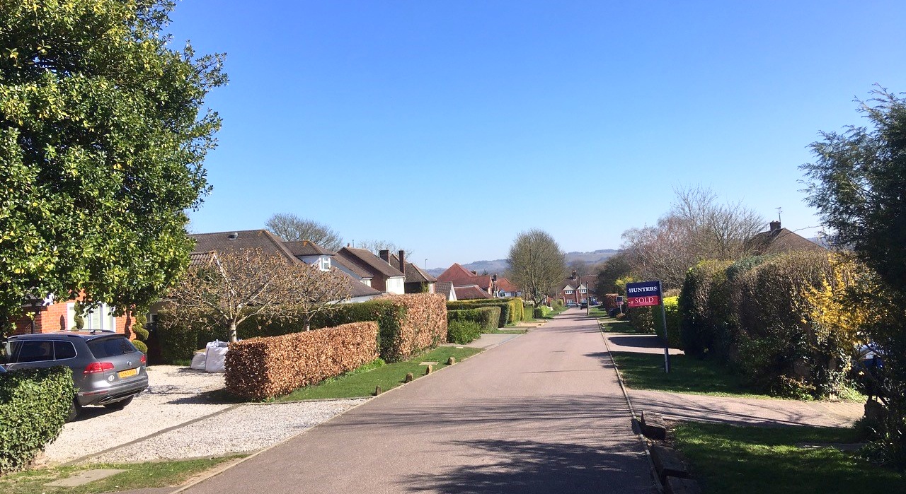
Bunstrux 2020
– photo S. Gordon.
From the beginning of its development, Bunstrux has remained a
private un-adopted road. In 2009 a residents’ association was
formed and the funds raised to have the road, previously unmade and
potholed, metalled. It is now maintained by the Bunstrux
Residents Association.
Sue Gordon.
April 2020.
――――◊――――
Footnotes.
1. Queen Matilda was the granddaughter of Earl Eustace, Count of Boulogne,
who held the Manor of Tring in 1086. She was also the wife of
Stephen of Blois, later King Stephen of England, and together
Matilda and Stephen founded Faversham Abbey in Kent in 1148.
2. “The Mannor of Bunstrux and Rycardyngs was also Parcel of the
Revenue of the Church of Faversham, and the Abbot and Monks there
granted this Mannor-house or Chief Messuage etc. with Houseboot,
Hayboot, and Fireboot in their Wood in Tring, called Westwood from
time to time when it was necessary to take it and also yearly
Pasture for the Feed of two Horses, and six Oxen for the Draught of
the Plough in the several Pastures of this Mannor of Tring, with the
yearly Feed of such Beasts in the same Mannor, and for all other
Animals sans Number, together with the Lords of Tring’s Cattle in
all the commonable Places of Tring whatsoever ……….”
Sir Henry Chauncy, The Historical Antiquities of Hertfordshire,
vol 2, page 550.
3. “Manors of Pendeley, Bunstreux, Richardynys and Halstowe, and 20
messuages, 10 cottages, 600a. land, 40a. meadow, 100a. wood, 100a.
pasture and 100s. rent in Albury, Pendeley, Bunstreux, Dunnesley,
Foord and Tryngge, worth 20l., held of the prince, as of his honor
of Berkhamsted, by knight-service.’” Inquisitions Post Mortem,
Henry VII [c.1485-1509] [C series II] vol 19 no. 20.
4. ‘Avowson’ - the right to recommend a candidate for an Anglican
church living.
5. No forename or title given but an entry in the Manor Court Rolls
suggests this was Mary Ellis the widow of John Ellis who died about
1757.
6. Bunstrux Manor otherwise Riccardines with Halstoe Court Book - ,
enfranchisement of 1 acre in the Butts in Benhill Field, Revd. James
Williams of Tring Park. The value of Williams' manorial rights was
15s to be paid as compensation to the Lord of the Manor as per the
Copyhold Act 1852. Williams had been admitted to the land in 1856.
The valuation was made by William Brown for Henry Frederick
Cavendish and others, Lords of the Manor of Bunstrux.
Hertfordshire Archives and Libraries
7. A well is marked on the 1897 Ordinance Survey map in roughly the
same position.
8. Addison Scheme – during WW1 the government was concerned by the
poor living conditions and subsequently poor health of military
recruits. The Housing Act of 1919 was the first move by the
government to introduce subsidised Council housing to address this
problem and provide “homes fit for heroes”. The act was also
known as the Addison Act after the then Minister of Health, Dr
Christopher Addison.
9. Parlour type houses had an extra living room and so typically
comprised a parlour, living room and scullery downstairs and three
bedrooms upstairs.
10. George Macdonald Brown was also known as Donald Brown. The
Brown family founded the estate agents in Tring that became Brown &
Merry. |
――――◊――――

|